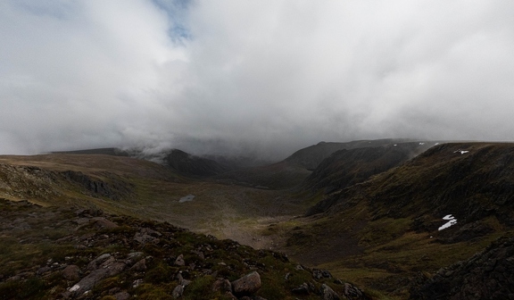
After excellent conditions the day before on the Macdui horseshoe, I was out again in search of more hills the next day. This time the forecast was slightly less favourable, and I’d have a substantially longer walk-in, to reach the most easternly region of the plateaux, and the impressively large Ben Avon.
Again I set out by bike, this time headed for the Linn of Quoich, which brought one of the most difficult cycles of my trip to the Cairngorms. The majority was fine, and along fairly well-compacted landrover track, until a point where the old path had clearly been washed away in a flood, and had been replaced with a stretch not marked on the map which climbed steeply and directly up the hillside. An unexpected and slightly unwanted surprise!
My aim was to leave the bike at the end of the forestry road in Glen Quoich, close to the end of the landrover track which descends down from Beinn a’ Bhuird, though shortly before I reached this point I encountered the river, which was too deep to comfortably take the bike across, and opted to leave the bike on the Braemar side, and continue on foot, wading across the water. From here I walked on the track which hugged the Quoich Water, through a remote area of forestry where the National Trust doesn’t attempt to control deer with fencing, but rather by putting little blue plastic “hats” on the growing parts of the trees to protect them from being chewed. The path continues deep through the woods, even after it’s been lost by the map, and eventually I met the path which comes up through the Gleann an t-Slugain, which is perhaps the more normal approach route for Ben Avon. From here the path started a very gentle climb towards a bealach—The Sneck—, following along a fairly considerable burn for most of the climb, past some large boulders, and loud waterfalls.
As I reached the bealach I found myself stepping up into cloud, and it would be the last view I’d have for some time; the bealach itself has a weird platform-like torr, and I paused here briefly for a snack before continuing onwards to the first Munro of the day. The climb from the bealach was short though initially steep, but eventually I found myself on the vast expanse of Ben Avon’s summit, with almost no visibility, following a bearing into the mist. Eventually a shadow started to form in the mist, and as I walked closer its shape started to become clearer; I was walking towards the summit torr, Leabaidh an Daimh Bhuidhe, the bed of the blond stag. Walking through the mist this megalith comes as a surprise, and looks haunting, the sort of place a game like Skyrim or Breath of the Wild would hide some powerful treasure guarded by a draugr or lynel. Ben Avon is arguably the hardest Munro in the Cairngorms to “bag”, since it involves a bit of scrambling; normally this wouldn’t have been too bad, but by this stage there had been drizzly rain for a couple of hours, and the rock was quite slick. My first route up turned out not to take me onto the highest point, and so I made a second attempt, and eventually decided I was in fact, this time, on the highest part of the mountain.
Feeling slightly miserable thanks to the conditions, and a bit frustrated at how hard I’d found what ought to have been an easy scramble, I made my way back to the bealach. From here I started the ascent up to the second of the Munros, itself on another expansive plateau. Beinn a’ Bhuird was once planned to become part of a ski resort, but walking across its summit it was hard to see how it would have been used for anything other than cross-country. The summit cairn isn’t far from the bealach, though I almost walked right past it; the path which followed the top of the cliffs over the corrie was more inviting, and it was only thanks to spotting two people off to my right in the mist that I realised my mistake!

Having visited the cairn I then started on my lengthy walk-out. I decided against taking the diversion up to the south top on my way out; it had been a long day, and I was keen to get back to Braemar before everything was shut. The descent path was good (it’s partially built on a landrover track which had been bulldozed for the failed ski centre, but it’s been largely restored by the NT). I managed to runn a few hundred yards here and there, though my knee still wasn’t thrilled at the prospect.
I eventually made it back to the bike, only to remember the unpleasant ride back out, but did, just about make it back to Braemar before everything shut.