- 2015
- 2018
- 002 - 003: Beinn Narnain & Ben Ìme
- 004 - 005: Beinn Vorlich & Stùc a’ Chròin
- 006 - 007: Beinn Tulaichean & Cruach Àrdrain
- 008 - 013: The Brothers & Sisters of Kintail
- 014 - 015: Ben Cruachan & Stob Dàimh
- 016 - 019: Ben Lui & the Tyndrum Munros
- 020 - 021: Beinn Dorain & Beinn an Dothaidh
- 022 - 023: Ben More & Stob Binnein
- 024 - 029: The Western Mamores
- 030 - 032: Beinn a’ Chroin, Beinn Chabhair, and An Caisteal
I’m now fast approaching climbing my hundredth Munro (indeed, until I recounted while preparing this blog post, I thought I was sitting on 99 already, but it turns out I’m not quite there, though by the time you’ll be reading this I should be!). I’ve been pretty bad about writing walk reports for each individual hill so far, and it’s high time I sorted that out by producing one great omnibus collection. It’s turned out that walking Munros has become one of the major focusses of life outwith work, so it seems only fitting that I give the effort so far a reasonable write-up.
I’ve ended up splitting this into three parts in order to try and keep the size of each post under control. This one covers 2015 (just one Munro!) and 2018 (31 Munros). I’ll put 2019 (Part 2) and 2020 in their own posts (12 and 26 Munros), and 2021 and 2022 together (25 and 1 Munros, since 2022 has only just started…).
2015
001: Ben Lomond
In comparison to later trips into the hills I managed to record upsettingly little about my first ascent of Ben Lomond (974m).

I remember that a group of us did it during the summer, starting from Rowardennan, but I can’t remember if we went straight up and down, or if we took the Ptarmigan ridge back down. What I do remember is that we were in clag for a decent amount of the walk, and there was no view to be had from the summit. At the time I remember being extremely put out by this (I imagine I carried a heavy camera with me) since I was there mostly to enjoy the views. These were very much the days before bagging was a major objective.
Edit: I’ve since checked with Magnus who’s fairly sure that we in fact made the ascent via the Ptarmichan ridge, and came down the more usual ascent track. This is a sufficiently surprising thing to have chosen to do that I believe he’s probably right.
2018
My Munro-bagging really started in earnest in 2018, with the plan to try and summit forty over the summer. While I didn’t quite make that goal, it’s fair to say that I managed to considerably increase the pace!
002 - 003: Beinn Narnain & Ben Ìme
The first two Arrochar alps also marked the first two big hills I did solo—something I’d, doubtless out of caution—avoided up until now. So on May Day 2018 I caught the train from Hyndland up the West Highland Line to Arrochar & Tarbert on the western shore of Loch Lomond. It was then a short walk around to the head of Loch Long to begin the climb up the forestry track which leads up to these hills. It wasn’t my first time up here, I’d climbed the Cobbler some time before, so I knew what to expect of the slightly gruelling walk up the switchbacks. In what might have been taken as a bad omen, I also managed to get very slightly lost trying to find the fairly obvious path up from the road, though fortunately I managed to avoid repeating this behaviour for the rest of the day.
The day was warm, and it was evident quite early on that I’d over-dressed, and that the choice of a thermal base layer was going to make things difficult. Things got less bad when I was up and out of the woods, and there was a bit of a breeze. The paths in these parts are good, and when I climbed Narnain a team was out building and repairing some of the paths up the hill. This certainly gave me a welcoming introduction to the Scottish hills, if, as it would later turn out, a rather unrealistic one.

This is the last hill I climbed without recording GPS for, but I’m fairly sure I climbed it along the Northwestern shoulder, and returned the same way, since my earlier route-finding had led to me not finding the ascent route from the southwest. Beinn Narnain (926m) remains one of my more favoured ascents even now; there’s a good variety, but nothing was ever too gruelling. The boulder field was quite enjoyable (I’m glad this is the attitude I adopted early-on to boulder fields!) and the views from the top stunning, almost making up from the lack of views I’d had from Ben Lomond.

I descended the same path to the Bealach a’ Mhaim between Narnain and Beinn Ìme (1011m), and started the climb up the butter mountain. The difference in character between the two hills is marked: Narnain is rocky and has a boulder field, Ìme is a continuous slog up a grassy (and rather boggy) slope. I seem to remember the climb going pretty fast, and also being amazed to see people out running on the hill (there’s a decent chance I now know these people too). I can’t remember anything especially remarkable about the climb, but the summit has a fairly large shelter, and a trig point. This also marked the first time I’d managed to climb something a full kilometre from sea-level, which seemed a nice achievement at the time. The descent was fast and easy, and then I had the fairly long walk back down past the Narnain boulders through the Coire a’ Bhalachain into Arrochar. Fish and Chips were ordered in one of the pubs along the shore, and I sat out in the sun until my train home.

004 - 005: Beinn Vorlich & Stùc a’ Chròin

Having very much caught the bagging bug from Narnain and Ìme I set out to do two hills with Shona on a Sunday afternoon. We couldn’t leave Glasgow until after lunch, so we’d need to make reasonable pace to get the two hills over Loch Earn. We managed to get started a bit before 2pm, and had the whole afternoon to bag the two hills. The first of the pair, Beinn Vorlich, was a straightforward climb up a well-trodden path, but its rockier neighbour required a reasonable amount of scrambling. After descending the second hill we contoured around Vorlich, where I discovered that my boots were coming to the end of their life, and had lost much of their grip (I slipped multiple times in the mud).
006 - 007: Beinn Tulaichean & Cruach Àrdrain
Equipped with new boots, the next pairing of Munros was to be two of the seven hills which lie just to the South of Crianlarich. We left Glasgow fairly early, on a warm, sunny day, and picked Magnus up en route in Callander. We had a long and frustrating drive from the A84 along the northern shore of Loch Voil, where a large number of people seemed to be driving out from a festival, with very little knowledge of how to drive on a single-track road. The climb up from Inverlochlarig to the summit of Beinn Tulaichean is steep, almost the whole way to the summit (946m), but once there we were rewarded with views both over towards Ben Vorlich and the other hills around Crianlarich and Tyndrum.
The walk to Cruach Àrdrain (1046m) was fairly easy, across a broad ridge, and the descent back down to the car was straightforward.

008 - 013: The Brothers & Sisters of Kintail
On the way south from Skye, having been to the Hebrides to run the Benbecula half marathon, Magnus and I decided to break the drive in Glen Shiel, and tackle the high ridge which runs to its north, joining the five sisters of Kintail. It didn’t take much persuasion or discussion to decide to add on the three munros to the east, the Brothers ridge, to make this into a six Munro epic.
We’d driven down from Slighachan on Skye the night before, and camped at the small campsite behind a petrol station in Shiel Bridge. We initially planned to set out as early as possible, but we only had the one car. The walk is along a lengthy ridge, and we were going to descend some distance from the beginning of the walk. Our solution to this was to catch the service bus which passes through the glen to the Cluanie Inn, so that we’d be finishing more-or-less back at the campsite, with the car. Had we planned further ahead a reasonable alternative approach to this would have been to drop bikes at the Cluanie end and walk the ridge in the other direction (the road being mostly downhill heading back out towards the coast). Things were mildly stressful in the morning, as we waited until 9am for the garage to open to pay for the campsite, and the bus was also due at 9. As it turned out everything was fine, and the bus was late, and so we were off on what would be a long adventure, in the sun.
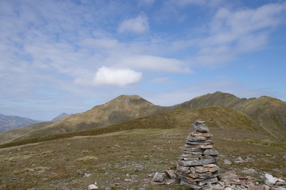
Initially the climb was fairly pleasant, but the temperatures rapidly started rising, and there was almost no breeze; it only took a short time before I noted the absence of my hat, which I must have left behind on the bus! The first summit of the day came quickly, after just under an hour’s climb, but there wasn’t much pleasure in stopping for a rest, thanks to the plethora of flying insects which were enjoying the unwindy conditions. It was around this point that I realised I hadn’t actually noted down which of the summits were munros, and so it became a necessity to touch every single cairn, and take a selfie at each, just to ensure I didn’t miss any. One of these was Aonach Meadhoin, first Munro of the day. We met a group of students from Edinburgh University’s mountaineering club here who didn’t seem to be travelling especially light, or fast. Going along the ridge we encountered other faster members of the party as we made our way along.
The next munro, where we stopped for lunch, was a much more distinctive beast. The ridge between Aonach Meadhoin becomes rocky, and eventually is built-up into a dry-stone wall in sections (and for no obviously discernible reason). The summit itself is slightly off the main ridge, but was also unmistakable, having an enormous and well-build cairn on it. We had a slight breeze here, which must have been the last we got for the rest of the day.
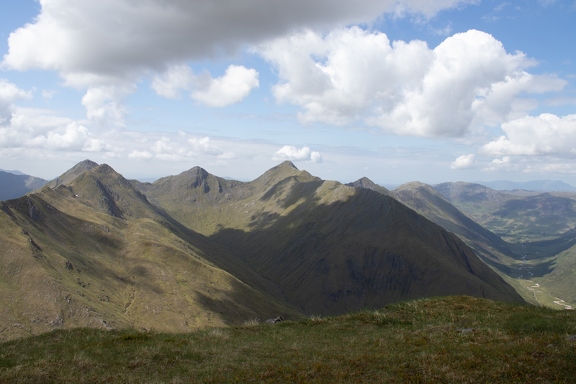
The final summit of the Brothers, Sàileag, came fairly soon afterwards, and from there we had a good view along the remaining ridge, the five sisters. By this stage we’d been out in the hot sun since fairly early in the morning, and I remember the fatigue starting to set in. I imaging the possibility of leaving the ridge here must have occurred to us, but perhaps the difficulty in getting back to the car was what persuaded us to go on (or perhaps it was the desire not to be beaten by a little sun).
From here the going certainly got tougher; there’s a reasonable drop between the two ridges, down to around 700m, and around 3km separates the last of the Brothers with the first of the Sisters. On a normal day that wouldn’t have been too bad, but it was tough this time. The first of the Sisters, Sgùrr nan Spainteach, a Munro top, was a fine introduction to the second half of this walk, with the entire length now curving out before us. Sgùrr na Ciste Duibhe was the first munro in the sisters, with another oversized cairn marking its summit.
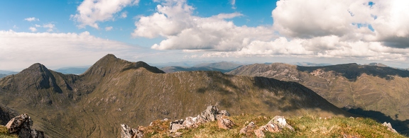
The 1997 Munro entrant, Sgùrr na Càrnach, was next, and somewhere along the ridge, possibly here, we stopped to rest, and we must both have briefly nodded off in the sun (going by the amount of time it later transpired that it had taken us to do the whole ridge). The walking along this ridge proved to be substantially more scrambly than the morning’s walk, and around this point we were both rationing water (or indeed, may have run out already), despite having started the day with rather a lot. It was a considerable relief, therefore, to reach Sgùrr Fhuaran, the final of the munros, and from there to descend back down towards Ault-na-Chruinn, and missing the final of the tops along the ridge. We ended up descending for a fair while without a path, but did, eventually, meet the main path again, and safely made it to the small village.
There we bought bottled water from a shopkeeper clearly surprised to see two people so excited to have found… bottled water…
There was a reasonable walk back around via the road to the campsite, but we were re-hydrated, and starting to think about the practicalities of food. We’d been on the ridge longer than we’d planned, and the original plan, which had been to head to Kyle for chips, was off the cards. We made do with whatever we had, and cooked it while dodging midges. We stopped for full cooked breakfasts the next day in Fort William to compensate!
014 - 015: Ben Cruachan & Stob Dàimh
It was time to return to solo munroing using the rail network. Once again I found myself catching the train out to Dalmuir from Hyndland, and then changing on to that all exciting diesel train which would wind its way along the West coast.

This time my ticket was for Falls of Cruachan, which was once a request stop on the Oban stretch of the line, but recently had become a regular stop during the summer months. I can’t honestly recall the outward journey as especially remarkable, though it was a sunny day and the temperatures were clearly rising as we headed north. From the platform at Falls of Cruachan halt there’s a path which leads up the hillside, making quite a steep ascent up to the level of the reservoir. You don’t immediately see the dam during the climb, and so you are fairly suddenly presented with the leviathan structure looming over you. A good bit of this part of the climb was through trees, and while they provided shade they also sheltered from the much-needed breeze, and so reaching the dam brought a little (though not much) relief from the heat.
I can’t remember if this was the first hill walk I did after deciding that audiobooks were the appropriate secondary entertainment, but this walk was to be soundtracked by A Game of Thrones, and as a result of this habit I now always connect fantasy literature with Scottish landscapes. Which doesn’t seem entirely inappropriate.
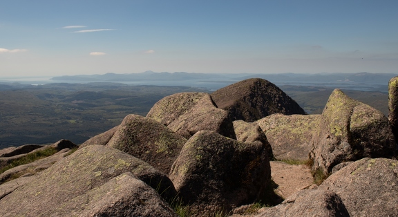
There’s a bit of a walk alongside the reservoir before the path leaves the concrete and starts climbing towards the summit. The climb is steep, and it wasn’t long before I reached the first of the day’s summits, Ben Cruachan (1126m), which at the time was the highest hill I’d climbed, and the first to cross the 1100m mark. Cruachan feels like a proper mountain, with a decent amount of rugged terrain towards the summit, and even after almost 100 Munros it sticks in my mind as one of the best, if not the best, that I’ve climbed.
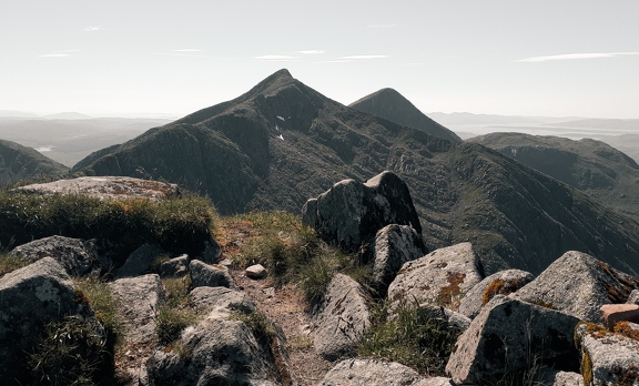
While a little tame in comparison to some of what we’d encountered on the Kintail hills, there’s a fine ridge between Cruachan and the next Munro summit along, Stob Dàimh, lay near the end of it, with the secondary summit of Drochaid Ghlas causing a little confusion along the way, not least because of its fairly considerable cairn! The route to get here also involved crossing some slabs, which weren’t difficult in their own right, but added a little excitement thanks to the drop to one side. The walk from Drochaid Ghlas was straightforward and Stob Dàimh wasn’t too far along.
I was pretty tired by this stage; I gone out considering trying to include the other two Munros, which are linked by a bealach to this horseshoe, but the heat had curbed my enthusiasm for that plan somewhat, and I decided it might be easier to finish on the Corbett at the end of the horseshoe, Ben à Bhùiridh. That meant continuing the walk over another fairly considerable peak, Stob Garbh, before descending to the final bealach. From here the Corbett looked imposing, and after a long day I was a little apprehensive, but it also seemed like a good place to finish up.
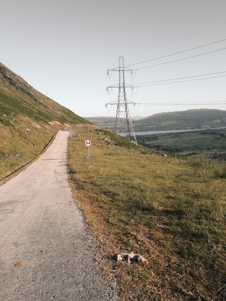
However, my carefully laid plans weren’t to work out. At this bealach I ran into to men, who I later find out were a father and son from the Netherlands, looking lost. It turned out they were struggling to find the descent route from the hill, which, sure enough, they missed some way back. I took pity on them, and feeling some alarm at the trainers they were wearing, and that they got this far with Google Maps, I helped them pick their way off the hill and back towards the reservoir, leaving them behind once the terrain levelled out a bit again.
I didn’t fancy climbing back up, but I also wouldn’t make it back to Falls of Cruachan for the last train which stopped there. So the long hydro road beckoned, and I followed it round to Loch Awe station. Getting there, I discovered there were delays on the line, and I was waiting around an hour longer than I anticipated for the train. This meant I wouldn’t be able to get a connection from Dalmuir back to Hyndland, and so I’d need to walk back from the city centre late on a Saturday. (Things were further complicated by the closure of Queen Street High Level, which added more delays to the train). So I had an interesting walk back via Sauchiehall Street, and a chance to be reminded of something which was perhaps the opposite of the peaceful hills! (Nowadays I have at least used a NextBike to cut 45 minutes off this walk!)
016 - 019: Ben Lui & the Tyndrum Munros
It turns out this is one of the few hills where I’d actually already made a post, but I’ve included it here, lightly edited, for completeness.
We’ve entered the third month of the exceptional summer of 2018, and it only seemed right to continue working on the T-shirt tan, and put a few more munros in the bag at the same time. After a few minutes of looking at the munro map I decided that the four munros near Tyndrum looked like a good target. With the plans made, I caught the train after work with Andrew and headed up to Tyndrum, where we met Shona at the camp site. Within 20 minutes I had my tent up, and we made as quickly as possible for the Tyndrum Inn to avoid the swarms of midges which were also calling Tyndrum home for the evening. Appropriately refreshed, we all turned-in early, ready for a fresh start on Saturday morning.
After a quick breakfast from the Green Wellie Stop it was time to head into the hills. Our walk-in was along 6km of landrover track through Cononish Farm, to the Eastern face of Ben Lui. Around half-way along the track the full view of Lui and the enormous Coire Gaothaich which dominates the eastern side of the mountain, forming the enormous amphitheatre which we’d be climbing up through. The walk up into the coire was straight-forward, and there’s a good path most of the way in, followed by a short distance over some boggier terrain to the buttress which lead up to the summit ridge. Approaching as we did from the northern edge of the coire, we encountered a cruel trick cairn on the lower of the mountain’s two summits; the munro summit was a short walk away! Just over two hours into the walk we’d reached our first summit (1130m), and completed the steepest of the day’s climbs.
Looking across to our next summit, Beinn a’ Chleibh, it was hard to believe it was a munro at all; it barely seemed to rise above its surroundings at all! A steep descent to the bealach made it look a little more impressive, but we still made it to the top (916m) just 40 minutes after our last summit. The day was well on track, and the conditions had stayed dry with a bit of cloud; perfect walking conditions. We descended to the bealach once more, and re-ascended part of Ben Lui, so that we could contour around to the bealach which joins Ben Lui and Ben Oss. We took advantage of the wind just above the bealach to stop for a midge-free lunch, and noticed that low cloud, and rain seemed to be rolling in from the horizon.
We soon pressed-on to start the second half of the day. The climb up Ben Oss wasn’t steep, but what looked like a fairly gentle slope on the map was in fact made up of undulating terrain, which just never quite managed to undulate as much as 10 metres to show up in the contours. After a string of false summits and a twisting ascent up the grass slope, we bagged our third peak (1029m) of the day; the first time Andrew and Shona had tackled more than two in a day. The threat of rain was looking pretty serious by now, but I tried to remain upbeat about our chances of completing the walk in the sunshine. After all, I’d yet to be rained-on on a mountain this year.
The descent to our final bealach of the day was fairly unremarkable, though a fairly large lochan had survived here. Our final ascent went by quite fast, though we’d all agreed to take things fairly easy by this stage, as we were starting to become aware of how long the day had been. On our right as we climbed I was amused to spot another lochan which was shaped like Northern Ireland. We’d soon climbed to a summit and the rain had finally caught us up, reducing the visibility considerably. So it was an unfortunate surprise when we spotted that the true summit was another 40 metres higher up, and about 200m away! Annoyed, but with just enough motivation to finish, we reached the summit of Beinn Dubhchraig (978m), where the wind seemed keen to blow us straight back down to the car park.
The descent from Dubhchraig was fairly gentle, but long, making up almost 6km of horizontal distance back to the car, but we made it back in time for me to catch my 2138 train to return to Glasgow.
Our total ascent for the day was just shy of 2000 metres, making this my biggest day yet in the hills in terms of ascent.

020 - 021: Beinn Dorain & Beinn an Dothaidh
After yet another week of un-Scottish summer, I formed a plan to get as far away from Donald Trump, who was forecast to arrive in Scotland, like an unwanted storm, on Friday to play golf. A quick look at the map, and a battle with the Citylink website suggested that heading up to the munros near Bridge of Orchy was a real possibility. Armed with this knowledge, and aided by the University closing at 3pm for Glasgow Fair I caught the bus, and headed North, away from the US President.
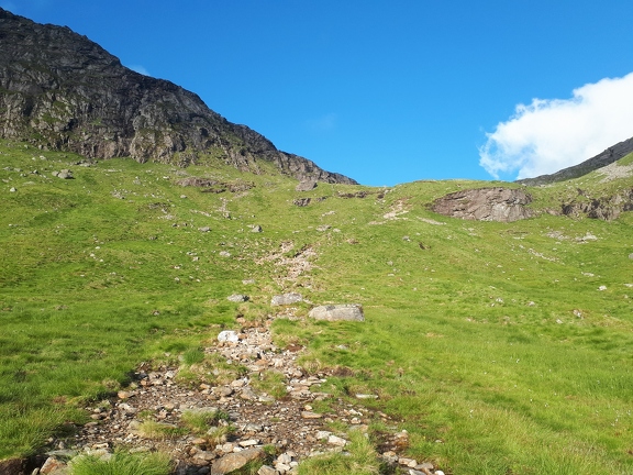
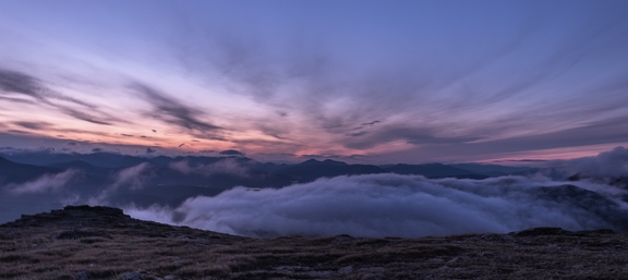
My plan was to climb to the summit of Beinn Dórain on Friday evening, and camp there. The climb up to the bealach was fairly straight-forward, if perhaps not the most exciting of climbs, and after around an hour I’d reached the cairn marking the fork in the path; on the right Beinn Dórain, and on the left Beinn an Dothaidh. The evening was clear and sunny still, but after another 100m of climbing things started to change, quite fast. Around half way from the bealach to the summit the cloud closed in, and the visibility was reduced to a few metres. I managed to wander along the path, starting to become a little worried that I’d stopped climbing, and seemed to be on a path which was contouring. A quick check with the GPS confirmed my suspicions, and I was left with the option of either scrambling up to the summit, or retracing my steps. I chose the former, and after a couple of minutes of straight-forward scrambling reached a cairn. From there I could just-about make out a second, much larger cairn. That was the (no-doubt affectionately-named!) Sassenach’s Cairn, which was a short distance from the true summit. I’d planned to make camp here, as it looked like it had more flat ground than the true peak. Since the clag had well-and-truly closed-in, I went ahead and pitched the tent, in the hope things would clear up enough to see my path to the true summit, and more crucially, a decent decent path towards Beinn Mhanach for the morning. After a couple of hours, I’d given up, and had retreated to the comfort of my sleeping bag, and the dulcet tones of Roy Dotrice reading A Clash of Kings. Just as I was nodding off I noticed a bright light coming through the tent from the West. The cloud had cleared, and for 15 minutes I was treated to one of the most dramatic sunsets I’ve ever experienced, looking over an inversion in the valley below me.
The rest of the night was to be cold and windy, however, and when I woke up at 6, planning to make a 7am start on the remainder of the Orchy munros the cloud was still thick, and the wind strong and cold. I decided to wait another hour, in the hope conditions would improve.
They didn’t.
I eventually decided that I wasn’t overly keen on trying to pick a decent route towards Mhanach with the poor visibility. However, after breaking camp, I picked my way along the path to the summit, and bagged Beinn Dórain (1074m). The strength of the wind had made my mind up. I wasn’t keen on trying to manage all five munros in the time I had (since I needed to catch the last bus back to Glasgow that night), carrying the full weight of my camping gear, so I descended back to the bealach, where I met a group of three walkers who had camped below the bealach, and had probably had a more restful night than I’d managed (they’d not lost enthusiasm for completing the round, anyway!). I think they may have been slightly alarmed to have been beaten up the hill in the morning before I confessed that I’d cheated by sleeping on it.
Feeling slightly buoyed by the improved visibility at the bealach I decided to climb Dothaidh, and I’d make my mind up about the other three once I got to the top. The visibility stayed pretty good as I ascended. The climb was easy, although I ended up taking a slightly boggier-than-optimal route, and it only took half an hour form the bealach to the summit. However, visibility here was even poorer than it had been at the summit of Dórain. I’d been looking forward to the views from the summit over Rannoch Moor, and, faced with a head wind for the next few kilometres I gave into temptation, and turned back down to the bealach, drawn by the thought of a hot lunch at the Bridge of Orchy Hotel.
I met up with the three early-risers I’d bumped into earlier again at the bealach, exchanged notes about the visibility, and then headed back down towards the A82, defeated. I passed plenty of people who were on their way up, most of whom asked if was windy at the top (once I reached a mirror I discovered that the combination of wild-camping and windy summits had restyled my hair, and I had that highly-desirable wind-battered look). I reached the railway underpass, with mixed emotions, around 1 o’clock, and headed straight to the hotel to get a cup of tea to warm up. Suitably re-tea-ed and re-fish-and-chipped I found myself with almost six hours to kill before the bus I was booked on. It turns out the river by the Bridge of Orchy makes a suitable place for a nap to make up for a poor night’s summit sleep.
Just before I caught my bus back I ran into the early-rising group of walkers once again. They’d done all five munros; apparently the weather on the far three had been great. Ahh, regret. I’ll have to come back again soon and finish the round.
022 - 023: Ben More & Stob Binnein
Fair Monday had rolled around, and it was time to do some more Munroing. Ben Cruachan was still sitting as my highest Munro at this stage, and it was time to surpass it, by heading up to the next set of Crianlarich hills. I’d recently joined a car club, and so I booked a car and was en route for the north of Loch Lomond, picking Andrew up along the way (Shona didn’t have the holiday, so we rather callously left her out, sorry Shona!).
The forecast wasn’t the most positive we’d had this year, but it remained dry on the drive up and through Crianlarich. We parked in the small lay-by, crossed the A85, and started the climb up a rough track. Even here it was clear that the ascent was rapidly about to become tough; the mountain is almost a pyramid, and there’s no route up which doesn’t look steep. We were perhaps fortunate that as we started the summit was in the cloud, and we never really got to see the full extent of the climb! This said, through being steep we made very fast progress up the hill, and we reached the summit less than 90 minutes after setting out, which may at the time have been a record for both of us.
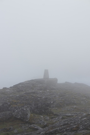
The cloud never really broke at the summit (1174m), though there were odd patches of visibility for a few moments where the hint of an excellent view became visible. There was something of an achievement to be had in knowing that the only ground higher than this in the UK was north of us, and I’d bagged the highest peak of this year.
We dropped down to the bealach between the two hills. I sometimes feel like starting to learn Gàidhlig has taken a little of the romance out of hill names for me, and this is a prime example: Bealach Eadar da-Bheinn which is simply the “pass between two hills”. That bealach, despite its uninspiring name, is high, and the re-ascent up the shorter of the day’s summits was soon underway.
We had a view from Stob Binnein (1165m), clearly that 9 metres made all the difference in getting us below the cloud line. We stuck around a while to enjoy the new-found view, before retracing our steps to the bealach, and heading down the fairly steep slope back to meet the landrover track, and from there it was a straightforward walk back to the car.
We headed up to Tyndrum to the Real Food Cafe to get chips, and picked Shona up from her site in Ardlui on the way home.

024 - 029: The Western Mamores
I’d now been picking off relatively local hills at a good rate, and it seemed like time for another expedition. I had some annual leave coming up, and so it was that I found myself on the train to Fort William with the bike, and heading to Glen Nevis campsite. I arrived in excellent conditions, dry and sunny, and calm. That wasn’t to last.
I spent the first afternoon pottering about Fort William, buying supplies, and working out what I was going to do with any time I wasn’t spending on the mountain. I should have brought climbing shoes, I realised, as there’s a climbing centre. I did manage to spend a little time in the bookshop, and then checked the updated forecast from MWIS. Things didn’t look great.
My big plan for the week was to complete the Mamores traverse. It was an ambitious plan, for sure, but I reckoned I was up to it. It did, however, demand reasonable weather, and the forecast was full of thunderstorms. I waited it out for a couple of damp days, and one spectacularly nice day which had forecasts for lightning which never arrived. It wasn’t too much of a loss, I had a copy of Dune with me, which I managed to finish on the holiday.

When finally the window arrived it was to be an overcast and slightly damp day, but it was also my penultimate day in Fort William, so I wasn’t getting any better options. The plan was to start the group of 10 summits from the West, and finish in the East before returning through Glen Nevis itself. It was to be a major outing, and so I started early in the morning, though put off by the rain, perhaps not as early as I should have, and cycled from the campsite through the Glen to the foot of Mullach nan Coirean, the first of the hills in the range. The climb up this hill was pretty brutal, and the path soon became lost in a mixture of heather and felled forestry, making for a steep climb up the side of the hill. This of course also meant that I had the advantage of reaching the summit (939 m) rather quickly!
The next hill I had spotted as I was cycling in through the Glen, and it’s pretty unmistakable, since it looks like a hill which, in August, still had a topping of snow. Crossing from Mullach nan Coirean to this hill, Stob Ban (999m) meant crossing the “snow” field at the top, which is in fact quartzite, which stands in such contrast to the other rock in these hills that you get this sharp contrast. Walk Highlands assures me that this peak has a good view of Ben Nevis. I had a good view of cloud, which is basically the same thing, right?

The traverse continued onwards and across to Sgùrr an Iubhar, which, until 1997 was itself a Munro, but in the opaque and ethereal wisdom of the SMC it’s now a Munro Top, and went past the rather pretty Lochan Coire nam Mìseach, which is bounded on three sides by an amphitheatre of cliffs. I left my rucksack close to its cairn, and headed across the first of the day’s ridges leading to Sgùrr a’ Mhàim (1099m), the Devil’s Ridge. Going North across this didn’t seem so bad, though it was getting cold, it was damp, and a little windy. I think by the end of it my head for heights had been largely exhausted, and I ended up dropping down a bit of height and contouring back around, which probably delayed me a lot more than just taking my time over the ridge on the return would have.
Reunited with my rucksack it was time to head on to the fourth Munro, Am Bodach (which means “The Old Man” in Gaelic, and is.. erm… slang… for something else in Irish [not that there aren’t hills in Scotland deliberately named like that…]). I can’t claim to have any strong memories of this hill; it should have a good view over Kinlochleven, but I suspect I was in cloud throughout the time I’d have had any view South (indeed, I was in or above cloud for most of the day). I was, however, starting to become aware that time was passing quickly and I wasn’t even half way through the traverse.
The next section was steep and rocky, coming off Am Bodach and heading to Stob Coire a’ Chairn, which stands at the junction of three ridges. The slope here became scree covered, and progress was very slow, and it was a relief to finally make it onto the grassier slope leading up and onto Stob Coire a’ Chairn (981m). Here I had a choice to make. Time was running short, and there was a lot of distance still to cover. I was also a bit unsure of the path through the Glen once I got back down off the furthest Munro, and didn’t fancy dealing with boggy and hilly terrain in the dark [2022 note: how times change!]. I could leave my rucksack here, and try and nip out across the ridge to An Gearanach quickly, and back to here in order to complete the ridge, or I could take it with me, and realise that I’d resigned myself to only summitting six of the ten hills. Sense got the better of me, and I resigned myself to coming back for the other four some other time.
There was more scree, and then a steep climb to An Garbhanach, and a little scrambling. It was nothing quite like as serious as the Devil’s Ridge, however, and from An Garbhanach the climb to Munro number six of the day, An Gearanach, was easy.
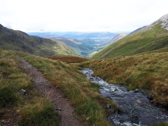
The descent off the ridge was much easier than I’d anticipated, following a zig-zagging stalker’s path (I’d been worrying a lot about navigating the descent off Binnean Mòr for most of the day, so in comparison this really did feel tame). I reached the floor of the glen again, and then had the fun of trying to work out how to cross the Water of Nevis. One Walk Highlands route had suggested crossing at stepping stones near Steall Falls, but I didn’t manage to find these. In the end I attempted to pick my way across, and ended up with wet feet (and, if memory serves, wet everything else too, I think I managed to fall over into the water). I did manage to find the steel rope bridge, which, with slightly jelly legs after many miles on the hill was a little terrifying. It wasn’t made better by the kid at the other side who didn’t seem to realise that bouncing the cable might have negative effects! However, I did manage to cross this one safely, and soon I was en route back to the bike along the road. It started to get dark shortly before I made it back, and it was a viewless cycle back in the end of the twilight to the campsite. In what was becoming a bit of a tradition, the chip shop at the campsite was closed by the time I returned.
Looking back on this trip I’m still a bit frustrated with it (though it was also a little over-ambitious considering my experience at the time), and it’s left me with the quandary of whether I try and complete the remaining four hills as part of retrying the whole ridge, or do them on their own. I’ve tried the latter once, though another forecast of lightning put paid to it before it began. So perhaps the answer is in doing the whole ridge. These days I might even try running it.
030 - 032: Beinn a’ Chroin, Beinn Chabhair, and An Caisteal
The season was coming to an end, and September would bring a new set of draws on my weekend time, so the last weekend in August looked set to be the last big hill day of the year. I joined Andrew and Shona as they headed up to Crianlarich where they were planning on climbing Beinn a’ Chroin and An Caisteal. I, of course, had more ambitious plans, and wanted to bag Beinn Chabhair along the way (they’d both done it the year before, and I couldn’t stand to leave one hill unbagged in this area over the winter, apparently). We started out in rather dreich conditions from a rather uninspiring lay-by off the A82, and crossed under the railway line. There was a lot of work going on around here to install a new hydro scheme on the River Falloch, so we had a brief period on a fairly well made path before soon heading off across rather wet and boggy grass. We had a fairly gentle climb up to around 400m, more-or-less following the river, and then a fairly short and steep climb up to the ridge with Beinn a’ Chroin’s many (two) summits. Here the mission became one of touching every cairn; the eastern summit has, in the past, been regarded as the true summit, while the western one is now the accepted summit, further along the ridge.
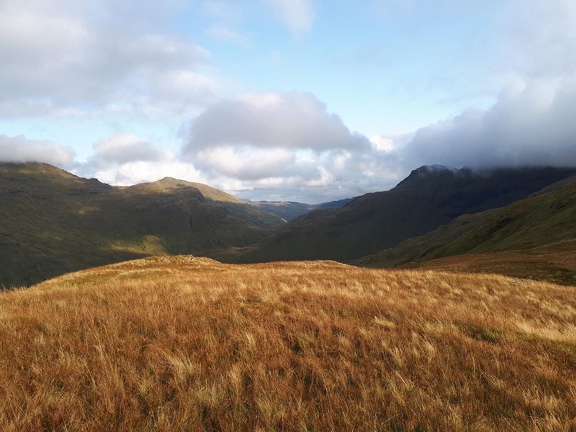
We continued a little further together, dropping down to the bealach which joins An Caisteal and Beinn a’ Chroin. Here I headed off to the West across rough ground to climb to the peak of Beinn Chabhair, probably not adding a lot more than an hour onto the whole walk. The summit was marked by a small cairn, but, from this approach at least, it wasn’t the most remarkable of hills. I was now in a bit of a hurry to try and catch-up with Andrew and Shona again, and didn’t linger long on the summit of An Caisteal, but made good progress along the descent which runs down a nice gently-sloped shoulder, and for the first time as I crossed Twistin Hill the sun finally came out. I made it back to the car some time after Andrew and Shona, but they didn’t seem to be too put out by my delay!